Isle Royale Northeast Loop
The Good Place
Isle Royale National Park is in Lake Superior, closer to Ontario, Canada than to the Michigan mainland it technically belongs to. The Ojibwe name for the island is “Minong” (pronounced “MEE-nong”), which is often translated as “the good place.” Reaching the island requires taking a seaplane, a ferry, or private boat. Once you arrive, cell service is extremely limited and there is nothing to resupply from beyond the minimal collection of items the camp stores on either end of the island stock. It is consistently one of the least-visited national parks, and yet one of the most-revisited by the people who actually make the trip.
Getting There
The two main options for reaching the island are seaplane and ferry. Since we took a seaplane on our previous trip in 2022, we decided to take the Isle Royale Queen ferry out of Copper Harbor this time. The crossing to Rock Harbor takes about 3.5 hours. Loading was easy, and conditions were as good as they could get. I did not think it was possible for Lake Superior to be so calm!
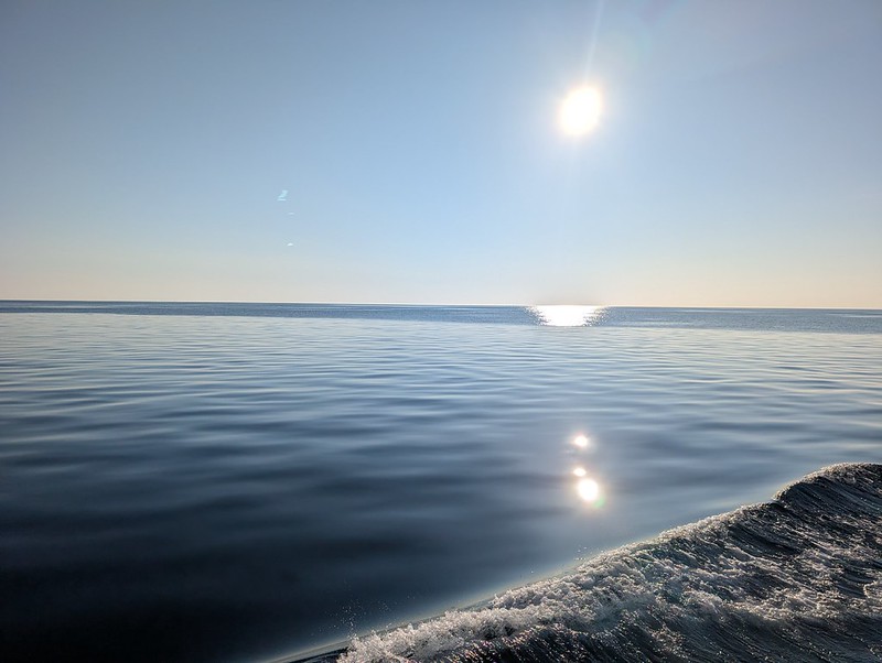 The still waters of Superior
We spent most of the ride sitting outside in the rear seats, occasionally wandering up front to check the view, before moving up to the bow for the last half hour. Docking in Rock Harbor went smoothly, and the ferry crew unloads the boat while a ranger gives an orientation talk.
Trip Report
Day 1: Lookout Louise, Jurassic Park, Mt. Franklin, and Lane Cove
Once off the boat, we listened to the ranger orientation (don’t feed the wolves!), grabbed our packs, filled out our permit, topped off water bottles, and had our packs weighed. The scale said 14 lbs. for mine, pre-water weight! From there we headed to the Rock Harbor Lodge to check in for the water taxi, ate a quick lunch, and caught a 15-minute taxi ride out to the Hidden Lake dock to start hiking.
 Rock Harbor
 ~14 lbs., not bad!
The trail to Lookout Louise wound through an old burn zone, and the elevation gain up to the Greenstone Ridge felt gradual. Lots of raspberries to pick nearly the entire climb. The views from the top were great! If there had not been a signpost marking the junction with the Greenstone Ridge Trail, we might have walked right past it. This was our first hint of what the trail had in store for later.
 Hidden Lake
 Monument Rock, once the ancient shoreline of Lake Superior
 Burn zone on the way to Lookout Louise
We took the spur out to Lookout Louise, which offered great views of the Sleeping Giant, Thunder Bay, and Canada to the north. Based on the surroundings, moose were big fans of the lookout, too. Lots of droppings and bedded-down areas.
 The Sleeping Giant from Lookout Louise

 Duncan Bay from Lookout Louise
Returning to the Greenstone, the first mile of was open and scenic through more of burn areas. We were able to watch a seaplane come in to land in Tobin Harbor as well as see Queen heading out for its return voyage to Copper Harbor.

 Wide open views on the Greenstone
Once we left the burn zone, the next four or so trail miles turned into a scene out of Jurassic Park. Heavily overgrown, with thimbleberry bushes growing chest- and head-high in stretches, and no real views to speak of. We just kept pushing through and were relieved to finally hit the junction with the Mt. Franklin trail.
 Look carefully and you can see the velociraptor
We ran into a boater resting there who mentioned Lane Cove was crowded and that he had seen a fox in camp. We headed a quarter-mile further to Mt. Franklin itself even though we would pass it again the next day. The view from the bluff was excellent, and we met up with the rest of the boaters’ group as well as another couple while we were there.

 View from Mt. Franklin on day 1
Returning to the junction, we headed north to Lane Cove, with the trail dropping steadily off the ridge. We crossed several stretches of boardwalk through marshy ground, and many mosquitoes came out to greet us along the way.
 Boardwalk on the way to Lane Cove
We reached camp to find it nearly empty, just the boaters’ dinghy and a canoe pulled up on shore, no other people. We checked out all five sites and settled on site #3, with the food storage conveniently between our site and site #2. Once camp was set up, we got in the water to cool off and made dinner. As the wind died down, the mosquitoes appeared in greater numbers. We could see a couple of boats moored out in the cove, and the boaters arrived to head back to their main vessel. The sunset was a good one, though somewhat obscured by a line of trees between camp and the shore. We were in bed shortly before 10. The next morning, my brother mentioned that he saw a fox outside his tent peering in at him around 11:30!
 Lane Cove

 Sunset at Lane Cove
Day 2: The Greenstone Ridge, Mt. Ojibway, and the Dismal Reputation of East Chickenbone
In the morning, I foraged thimbleberries to add to my breakfast oatmeal and packed up camp, leaving around 9:15. It appeared only one other group had camped at Lane Cove that night. The day started with a big climb back up to the Greenstone Ridge, and we passed a group of four heading down toward the cove.
 Breakfast of champions: just add oatmeal
At the Mt. Franklin junction, we met two people heading back to Rock Harbor who raved about Todd Harbor and McCargoe Cove and told us to check out the view from group site 1 there. We stopped at Mt. Franklin again, and the view was even better this time with clearer skies than the day before.


 Views from Mt. Franklin on day 2
We continued west along the Greenstone Ridge Trail, which opened into long, scenic stretches of ridgeline. We had sweeping views both south to Rock Harbor and the lighthouse and north to Canada, along with plenty of wolf sign along the trail. We even stumbled upon a USGS survey marker.
 Rock Harbor Lighthouse from Greenstone Ridge
 Canada and the Sleeping Giant
We stopped for lunch at the Mt. Ojibway fire tower and dried out gear in the sun. The fire tower offered fantastic views of both ends of the island and across to Canada. We were joined by a solo backpacker we recognized from the ferry and orientation. He said that on a very clear day you can see all way to the Keweenaw Peninsula. We also informed us that he too had survived the bushwhack from Lookout Louise back Mt. Franklin.
 Mt. Ojibwe fire tower
 Looking northeast from the fire tower
 Looking south to Moskey Basin
 Looking southwest from the fire tower
At the junction of the Greenstone and Daisy Farm trails, we met a group of four coming from East Chickenbone, one of them hauling a case of Pabst Blue Ribbon beer strapped to his pack. They told us about an upcoming viewpoint, which we made a point to check out. Make sure to continue past the first view until it really opens up.
 View from the viewpoint
 Me admiring the view
Not long after, we passed through a section that looked like it might have been rerouted, marked with ribbons and cairns instead of a clear, well-worn trail.
A big descent off the Greenstone Ridge brought us toward East Chickenbone. We passed the East Chickenbone camp, and it looked every bit as dismal as reviews indicate. We skipped the spur down to the lake and pushed on toward McCargoe Cove.
 Chickenbone Lake
The stretch of boardwalk around Chickenbone Lake, including a set of steps, was heavily overgrown, and we tripped more than a few times before finally clearing it. We decided we would give East Chickenbone a low rating despite never actually staying there. We crossed a flowing stream that fed into the cove just before reaching the actual McCargoe Cove camp.
 Frogs hanging out in the swamp
 Mouse we passed on the trail
 Stream just before McCargoe Cove
At camp, a few of the shelters were already taken, so we grabbed number 5, unloaded our packs, and went for a swim. We washed clothes, filtered water, and hung the laundry to dry while setting up in the shelter for dinner. We wandered over to check out group site 1 but were puzzled to find nothing resembling the view the two hikers we met earlier mentioned. On the way back, we gathered firewood and chatted with some teenagers around the fire pit. Eventually we went and sat down by the water until the mosquitoes chased us off.
 McCargoe Cove Shelter #5
 End of the cove when the stream enters
 Looking northeast up the cove
 Loon swimming in McCargoe Cove
Day 3: Minong Mine, the Minong Ridge, and a Broken Backpack
I slept well, got up around 6:30 AM, and headed down to the shore to watch the sunrise. The earliest colors were pretty, but clouds rolled in before the sun actually cleared the trees and turned the sky to muted grays.

 Sunrise at McCargoe
I backtracked about a quarter-mile along the trail to forage more thimbleberries to add to my oatmeal. I went down to the dock to eat, and talked a bit with a family that had arrived by boat. The grandfather had built the boat himself by hand!
 The handmade boat

 Morning at McCargoe
We took our time breaking camp. On the way out, we stopped to help a pair of hikers, one of whose huge backpack was tearing apart. We provided some duct tape and med wrap and wished them plenty of luck, as they planned to hike the length of the Minong Ridge to Windigo/Ozaagaateng.
About a mile in, we stopped at Minong Mine. I climbed down into an old mine to look around. There are numerous piles of rock tailings, many more than at Island Mine, which I visited on my last trip. The ideal way to explore the mine would be to visit as a side trip from McCargoe Cove without packs. From the mine, the Minong Ridge Trail alternated between open, rocky outcroppings and dropping back into forest. We took a break and had lunch up on one of the open stretches, with views down to Otter Lake below and Canada across Superior. Feeling bold, I ate three blueberries, making it a triple-berry day!
 Entrance to a mine shaft at the Minong Mine
 Inside a mine shaft
 Rock tailings and blacksmith forge
Eventually the trail settled into forest and turned surprisingly cruisy. Much nicer walking than I expected based on reports about the Minong’s ruggedness. From what I understand, it does not get truly rugged until the section between Little Todd Harbor and Windigo/Ozaagaateng. The trail alternated between rocky ridge walking and dropping down just below the ridge through the forest.
 The Sleeping Giant from the Minong Ridge
 Thunder Bay from the Minong Ridge
 Otter Lake from the Minong Ridge
We foraged plenty more thimbleberries and spotted a shed moose antler lying beside the trail. The last half-mile threw one more battle with head-high thimbleberries at us before we made it to Todd Harbor around 3 PM. Much to our surprise, the broken-backpack crew we helped that morning was already there, their field repairs holding up. We never saw them on the trail, but they must have passed us when we were exploring the mine.
 Todd Harbor
 More views of Todd Harbor
The single shelter was already taken, so we checked out all the campsites. Group site 1 around the cove and past the dock had a spectacular view of Lake Superior but tricky water access: you either scramble ~10 feet down a small bluff or backtrack a quarter mile towards the dock. It finally clicked that the hikers we had talked to two days ago were recommending group site 1 at Todd Harbor, not McCargoe Cove!
 Looking out at Lake Superior from group site 1
We settled on site 4 as it was closest to the water and the food storage box, though it required finessing our the tents under tree cover to avoid roots while staying reasonably level. By late afternoon it was busy, with plenty of tired-looking arrivals coming in well after us. We recommended group site 1 to everyone we talked to who was still trying to find a spot.
 Our campsite at Todd Harbor
We had dinner around 5:30, with no rain yet. We went down to the beach to hang out on the rocks, filter water, and discussed options for the next day’s route. I talked with two hikers from Grand Rapids for a bit as well. It rained briefly, causing us to head back to camp. We re-emerged to head back to the beach, then it started raining again, and across the harbor it looked like heavier rain was moving in. Unfortunately, all the rain and clouds meant no sunset for us. We retreated to the tents around 7:45 and I was asleep by 9. A steady rain fell but mostly stopped by midnight.
Day 4: Backtracking to McCargoe, Then On Toward Chippewa Harbor
We decided to retrace our steps back to McCargoe Cove, a few miles shorter than continuing further west on the Minong, looping south past Hatchet Lake, and heading back east on the Greenstone. This also gave us the option to stop at any of McCargoe Cove, West Chickenbone, Lake Richie, Moskey Basin, or Chippewa Harbor depending on how the day went. We at least knew the first seven miles would be fairly easy trail.
 Islands illuminated by morning sunlight
The people in the shelter had their phone alarm set to the A-Team theme song, which began blaring at 7 AM sharp. I gathered thimbleberries and raspberries for breakfast, roused my brother around 8 AM, and were on the trail by 9:15.
 Thimbleberries in their native habitat
Along the way we met a solo hiker heading the opposite direction who told us, with eyes as wide as saucers, that they had just seen a bull moose walk across the trail five minutes before. We scoured the woods as we continued on but saw no sign of it. Missed it by that much! We made good time back to McCargoe, stopping for a break at the best view along the way and catching and passing one pair of hikers.
 The best view on this section of the Minong, near the west end of Otter Lake
 The Sleeping Giant
We reached McCargoe at 12:30, went for a swim, filtered water, and had lunch. All the shelters looked full, which made it easy to decide to continue further along the trail.
 Hello McCargoe, my old friend
Back on the trail by 1:30, we took the Indian Portage Trail toward West Chickenbone: pretty level going, just a little overgrown, and easy on the feet. The clouds burned off and we had nice views of Chickenbone Lake as we contoured around it. We reached the campsites around 2:45, took a break, and refilled water.
 Looking east across Chickenbone Lake
 Campsite at West Chickenbone right on the water
From there it was a big climb back up to the Greenstone Ridge, with a confusing multi-way junction that our GPX track helped sort out. A gentler descent followed on the Indian Portage Trail away from the ridge. We got beautiful views of Lake Richie along the way and at the campsites there.

 Great views of Lake Ritchie
 Looks like an otter buffet!
 Break time at Lake Ritchie
While we stopped for a break and filtered water, we debated Moskey Basin versus Chippewa Harbor. We agreed to decide at the junction itself. After our experience on the Greenstone on Day 1, I was a little worried that the 4-mile spur trail toward Chippewa might be badly overgrown. The Lake Richie camp looked full, and as we approached the junction, two hikers we talked to said they had come from Moskey Basin. They told us Moskey was overflowing, with people setting up in random spots on the rock bluffs.
 A curious snake
 More Lake Ritchie
At the Moskey Basin/Chippewa Harbor junction, I made the call to head for Chippewa, shifting into a crush-some-miles pace. We had several of our fastest miles here, with a couple of them over three miles an hour. We mixed in a few brief breaks and made it to Chippewa Harbor by 6:45. Much to our disappointment, every shelter was taken by boaters, with possibly one group of hikers in the mix. A hiker couple sitting at the picnic table by the dock pointed us toward the group site, which turned out to be great! It had a large grassy area as well as a tiny beach right on the water.
 View from our tiny beach back towards the Chippewa Harbor dock
 Looking out Chippewa Harbor


 Golden hour at Chippewa Harbor
We took a dip, filtered water, and made dinner. A guy walking through camp recommended a spur trail up the bluff to an overlook and/or to an old schoolhouse, so after setting up tents and stashing food, I decided to check it out. The route up the rock bluff to the overlook was a little tough to follow, but cairns marked the way in several places, and the 360-degree views from the top were excellent.


 Views from up on the bluff
 Fading light from my tent site
We called it a night around 9:30 PM. I woke up at some point in the middle of the night and emerged from my tent to get a great view of the Milky Way.
Day 5: Chippewa Harbor to Moskey Basin
 Good morning, Chippewa Harbor
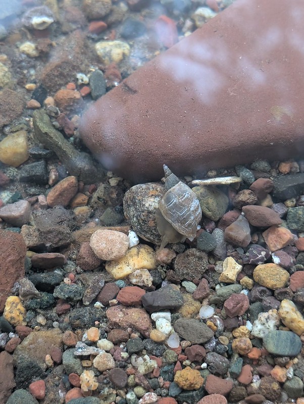 Snail in the water
 Tent site at Chippewa Harbor
I got up around 7 AM and supplemented my breakfast with thimbleberries and raspberries again. I ate down at the dock, talking with a boater and a hiker. Park rangers arrived on a boat and seemed relieved to be able to claim a shelter that had been vacated earlier in the morning. I stopped by the old schoolhouse to look around, then climbed back up the bluff to check out the view in the morning.

 Old schoolhouse at Chippewa Harbor

 Interior of old schoolhouse
 Chippewa Harbor from shore near old schoolhouse

 Morning on the bluff
I nearly hopped in the water before deciding I had managed to cool off enough while packing up camp. It was a leisurely morning, and we didn’t hit the trail until 10:30, with less than 7 miles to Moskey Basin.
We passed at least 12 hikers on our way to the junction. Four of them had seen a wolf on the trail about an hour earlier. While stopping for a quick break in a clearing, we saw what looked to be a bald eagle soaring above us.
 Possibly a bald eagle?
We reached the junction around 12:30 and took a break there, holding off on lunch until Moskey Basin. Along the way we met two rangers who had been out paddling Lake Richie. We got into Moskey shortly after 1:30. All the shelters were full, but we snagged campsite 5, just across the trail from the water.
 Home stretch into Moskey Basin
We dropped our stuff, jumped in for a swim, and dried off in the sun before making lunch and lounging for a while. We checked out the dock and the bluffs, then went back and set up camp properly.


 So many amazing views at Moskey
 Water snake
 Sandpiper on shore
 Another very curious snake (my shoe at bottom left)
We ran into the hiker couple we met back at Chippewa Harbor and spent some time lounging on the rocks by the water. Dinner was around 5:30, and we hung out on the rocks a bit longer afterward. My brother was running out of steam and turned in around 8 PM. I went exploring past the dock and found a path along the bluffs and went back out there for sunset. We had one last big day ahead: 10-11 miles to make it back to Rock Harbor by 2:15 PM to catch our ferry.
 Bluffs as clouds roll in in the evening
 Cormorant swimming below the bluffs
 Cormorant taking a nap
 Naptime is over


 Colors coming out as the sun sets at Moskey
Day 6: Daisy Farm, the Tobin Harbor Trail, and the Ferry Home
A surprise thunderstorm rolled in out of nowhere around midnight. My right arm and part of my quilt got wet as I was frantically trying to close my tent vestibule. The storm passed quickly, but I was concerned wet conditions might slow us down the next morning. I was up around 5:30 AM, woke my brother at 6, and we were on the trail by 7.


 Sunrise as we leave Moskey Basin
The first half of the trail was easy. We kept bracing for the difficult section the mom and son pair at Lake Ritchie had warned us about yesterday. The second half did get noticeably rockier the closer we got to the Daisy Farm campsite.
 On the trail to Daisy Farm
We reached Daisy Farm shortly before 10 AM, dried out our socks and shoes under the pavilion for a bit, and had a snack. We followed the trail down to the dock to filter water and asked a ranger for his take on the level of difficulty of the Rock Harbor Trail versus the Tobin Harbor Trail. He said if we had made it this far, either would be fine. We were surprised by how large Daisy Farm actually was, and to me it almost felt more like a state park campground. 16 shelters total, with several right down by the water. As we continued down the trail towards Rock Harbor, we started kicking around ideas for a future trip to Isle Royale to finally bring our brother-in-law out here.
 View from Daisy Farm dock
Past Daisy Farm we followed the Lake Superior shoreline along flat, easy trail with several small beaches, plenty of water access, plus nice views of the Rock Harbor Lighthouse and the park headquarters out on Mott Island.
 Small beach along trail with lighthouse in distance
 Rock Harbor lighthouse
 Park headquarters on Mott Island
We also passed through an old mining area. The last mile or so got rockier and more boulder-strewn. We talked with several other hikers along the way trying to make a final call on staying on the Rock Harbor Trail the entire way versus taking a quick detour inland to follow the Tobin Harbor Trail. The closer we got to the junction, the more thoroughly spent Rock Harbor Trail hikers we saw coming the other way. That settled it for us, and we headed up the Mt. Franklin Trail.

 Larger rocks and boulders along Rock Harbor trail
It was a short up-and-down from the Mt. Franklin trail junction to the Tobin Harbor Trail, where we chatted with a family for a few minutes. Nice, easy hiking followed the rest of the way. We stopped for an early lunch to finish off the last of our tortillas, salami, and cheese, and skipped the spur to Suzy’s Cave with thoughts of the Greenstone Grill on our minds. We passed several day hikers who confirmed we would eventually come to a spur trail back into Rock Harbor.
 Easy walking on Tobin Harbor trail
 Tobin Harbor
We reached Rock Harbor around 1:30, refilled water, stowed our packs in backpack storage, and headed straight for the Greenstone Grill. We enjoyed burgers, fries, and beer on the patio while watching a large sailboat come in. Heading back to the dock, we noticed a boater from Duluth that we had seen back at Chippewa Harbor was now in Rock Harbor. We snapped a few pictures in front of the Rock Harbor NPS sign, then made our way to the ferry dock. The captain warned us the ride back would be “spicier” than the trip out. Boarding was quick and easy. We sat in outdoor seats in the back of the boat again. True to the captain’s word, we had to keep one hand on the boat any time we moved around.
 Celebratory lunch at the Greenstone Grill
 We did it!
We got back into Copper Harbor around 6:15 PM. My brother’s bag came off the ferry quickly; mine took a while longer. We headed to the car and made a 45-minute drive to Culver’s in Houghton for dinner. They made a mistake with my ice cream, told me keep the first one, made another, and needless to say, we had no trouble eating everything, mistakes and all! They also gave me a certificate for a free ice cream from that location, so I guess that means I have to go back to use it! From there it was an easy drive on to a hotel in Marquette for the night. The next day we feasted at the breakfast buffet. Breaking up the drive home this way worked out really well.
Impressions of Campsites & Points of Interest
Lookout Louise
Lookout Louise was nice, but there are comparable views in many other places on the island. It’s worth it if you take the water bus, but I don’t think I would schedule a separate water taxi to go see it again, especially coupled with four miles of semi-bushwhacking through overgrown brush.
Lane Cove
Lane Cove felt quiet and secluded, with only five tent sites, no shelters, no group sites, and no dock. Getting in the water can be a little tough as the rocks are very slick. Campsites are right on the water, but views of the cove are somewhat obscured by trees. Definitely the way to go if you arrive in Rock Harbor and want to avoid the crowds at Three Mile or Daisy Farm.
Mt. Franklin
Technically a bluff rather than a mountain, it has great views. We stopped there twice, and it was definitely worth it. If you are doing a short trip based out of Rock Harbor, this is the place to go see.
Mt. Objiwe Fire Tower
Good location to stop for a break or lunch. Plenty of shade under the tower itself, while the supports can be used to hang out any wet gear to dry. Climb the tower to get the best views of the length of the island.
Signed Viewpoint on Greenstone
Worth the slight scramble upwards, keep going until the views really open up. One of the best vistas on the island.
East Chickenbone
Seems poorly situated, we were running low on water but chose not to bother with the lengthy spur to the shore. So many boardwalks! Almost fell off several times because the brush over the boardwalks was so overgrown. If you are thinking about staying here, just go to to West Chickenbone or McCargoe Cove.
McCargoe Cove
You really want to get a shelter here because the individual and group tent sites are quite a ways back from the shore. Most shelters are a bit up the hill too, but not as far as the tent sites. Based on our experience the rest of the trip, we were fortunate to get a shelter considering we arrived after 5 PM. All shelters were taken by 12:30 PM the next day. The way the campsite is situated at the end of the cove gave it more of a snug, cozy feeling. Water access was easier as rocks were much less slippery here, or just jump in from the dock.
Minong Mine
Stash your gear at McCargoe and do a separate trip to the Minong Mine if you want to really explore it without being encumbered by a full pack. Worth the side trip to see the largest mine on Isle Royale.
Todd Harbor
Known for its sunsets; unfortunately, it was overcast and rainy when we stayed here. Still enjoyable to sit on the cobbled beach. Go see group campsite 1. Even if you do not end up setting up camp there, it’s worth seeing the view of Lake Superior. At the opposite end of the harbor, there is a side trail to another mine, but the threat of rain kept us from checking it out.
West Chickenbone
Seemed like a nice spot. Although on an inland lake rather than Lake Superior, I got similar vibes as Lane Cove. Campsites are right on the water, felt quiet and secluded.
Lake Ritchie
Some really nice views of Lake Ritchie from the bluffs along the trail. It appeared full when we passed through, but it looked like the campsites would have good views of the lake from their perches up on the bluff.
Chippewa Harbor
We were disappointed to not get a shelter, but the group site just about made up for it. The group site also puts you much closer to the unmarked side trails to the old schoolhouse and path up the bluff to get 360-degree views of the area. That said, the shelters were situated on top of a rocky, open area that likely makes for great stargazing. Very popular site for boaters and paddlers in addition to hikers. One option for an easy trip would be to water taxi from Rock Harbor to Chippewa Harbor and hike back to Rock Harbor, stopping at Moskey Basin, Daisy Farm, and 3 Mile along the way.
Moskey Basin
The absolute highlight of our trip! As much as many of the other campsites feel cozy and tucked-in, Moskey blew me away with its size and grandeur. It’s a huge campsite, but in a good way. Even though it’s very popular, the sites are spaced out enough that it does not feel like you are on top of other people. The shelters are right on the water and have amazing views. We were not lucky enough to get a shelter, but tent site 5 was still pretty good. Great swimming, huge rock bluffs to explore, and the way the landscape is laid out makes it possible to see both sunsets and sunrises. Everyone should stay here at least once, if not every time you visit the island!
Daisy Farm
We took a quick break here and refilled water down by the dock. Good place to maximize your odds of getting a shelter. Felt more like a standard state park campground than most places on Isle Royale (had a pavilion, info boards, small sandy beach, etc.) It had mostly emptied out by the time we arrived, I can imagine it feels even more like a regular campground when it is bustling with people.
Greenstone Grill
If you make it back to Rock Harbor in time, the Greenstone Grill serves sandwiches, burgers, and beverages along with a variety of other snacks. We were glad we made it back in time to enjoy burgers and beer out on the patio after nearly a week of oatmeal, salami, cheese, beans, rice, and dehydrated meals. Service is very fast!
Food Storage Lockers
Although the food storage lockers are not reflected on any published or campground maps, we never had any problem finding them. Just look around each campsite a bit and you will find them centrally located somewhere. Many campsites have more than one.
Closing Thoughts
It was interesting to compare this trip to my first trip to Isle Royale to do the Feldtmann Loop. That trip was my first backpacking trip longer than one night, and a lot has changed in the four years since that trip.
Most noticeably, Isle Royale itself has changed. In 2022, there were more than 2,000 moose on the island. Since then, the population has plummeted to around 500. My recollection from 2022 is that we saw moose sign (typically droppings) consistently throughout the trails. While we saw some droppings and bedded down areas this trip, I would say a ~75% reduction sounds about right and matches up with the drop in population.
The flip side of that is that the wolf population has boomed from 10-15 in 2022 to nearly 40 today. Unfortunately, this is increasing the frequency of wolf-human interactions. Prior to our trip Duncan Narrows was closed and Three Mile was shelter-only (i.e. no tents) through the end of July. Ten days after we returned, Three Mile, Daisy Farm, Moskey Basin and Caribou Island were closed to tent camping for the rest of the season. Selfishly, I was hoping this increase in wolf activity might increase our chances of seeing a wolf, but we did not see any, just a couple foxes. Thinking more long-term, I am very concerned that improper food storage leading to more wolf-human interactions is going to result in more closures and negatively impact the overall experience on the island.
This trip felt like we saw many more people than the trip four years ago. Some of this is simply due to visiting some of the most popular campgrounds on the more “developed” northeast end of the island. We also visited a couple weeks earlier in August, which meant we were there before most schools started instead of after. Instead of being one of the first groups to arrive each day, we often found the campsites already close to full, even if we got there in mid-afternoon.
This was my longest backpacking trip by both length of time and mileage. Based on the experience I gained going on other trips over the last few years, I felt very prepared for this one. I was very happy with my gear and was able to move quickly and lightly. By the end of the trip, I did not feel worn down at all. I felt like if I had a resupply available, I could keep going for another week or more. Maybe next time I will go for a full circumnavigation of the island!